Ottawa’s trail running scene punches well above its weight for a capital city of its size — you can go from the front doors of Parliament Hill to deep wilderness in under 30 minutes by car. Whether you’re chasing personal bests on the groomed canal paths, building quad strength on the rocky ridges of Gatineau Park, or simply wanting to swap pavement for pine needles on a Saturday morning, the National Capital Region has a trail for you. The best part? Most of them are free, easily accessible by OC Transpo, and offer a complete change of scenery without ever leaving the city limits.
This guide covers the top trail running routes in and around Ottawa — from beginner-friendly farm loops to demanding technical climbs — with the specific distances, elevation gains, transit options, and seasonal intel you need to plan your next run with confidence.
Key Highlights
TL;DR: Ottawa is a trail runner’s hidden gem, offering everything from flat canal pathways perfect for beginners to the challenging rocky climbs of Gatineau Park’s Pink Lake Trail. The city rewards runners willing to explore beyond downtown — the Greenbelt and Mer Bleue Bog offer solitude and unique ecosystems, while neighbourhood routes like Westboro and the Rideau River give urban runners quick escapes without a car. Spring brings mud, summer brings mosquitoes, fall delivers spectacular colours, and winter opens snowshoe trails in Gatineau. Start with the Experimental Farm if you’re new to trails, progress to the Rideau Canal for variety, and tackle Pink Lake once your legs are ready for a real challenge.
| Quick Facts | Details |
|---|---|
| 📅 Best Season | Spring through fall (May–October) |
| 📍 Top Trail | Gatineau Park Pathway, 8.9 km loop, 216 m elevation gain |
| 🎟️ Cost | Free (city trails); $10/day Gatineau Park pass |
| ⏰ Best Time | Early morning — beat the crowds and the heat |
| 🚗 Transit | OC Transpo Lines 1/2/7 (Rideau Canal), 11/62 (Westboro), 24/97 (Greenbelt) |
Downtown Ottawa: The Rideau Canal and Experimental Farm
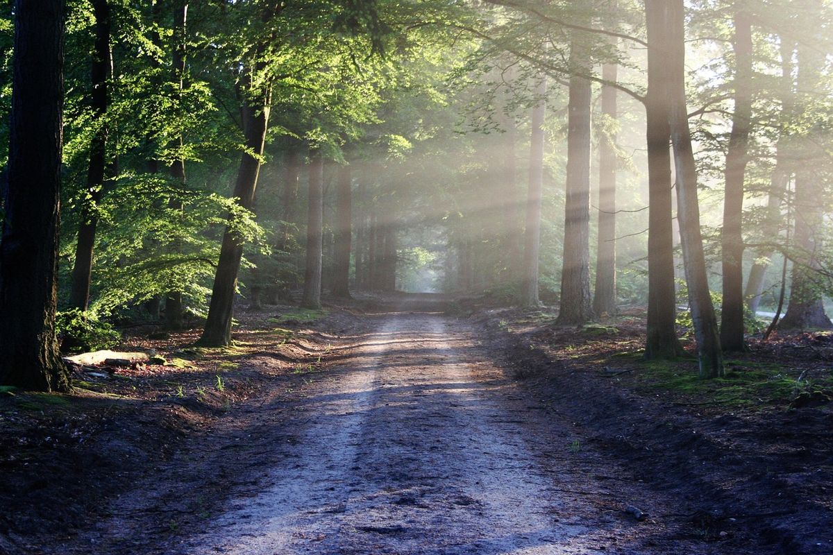
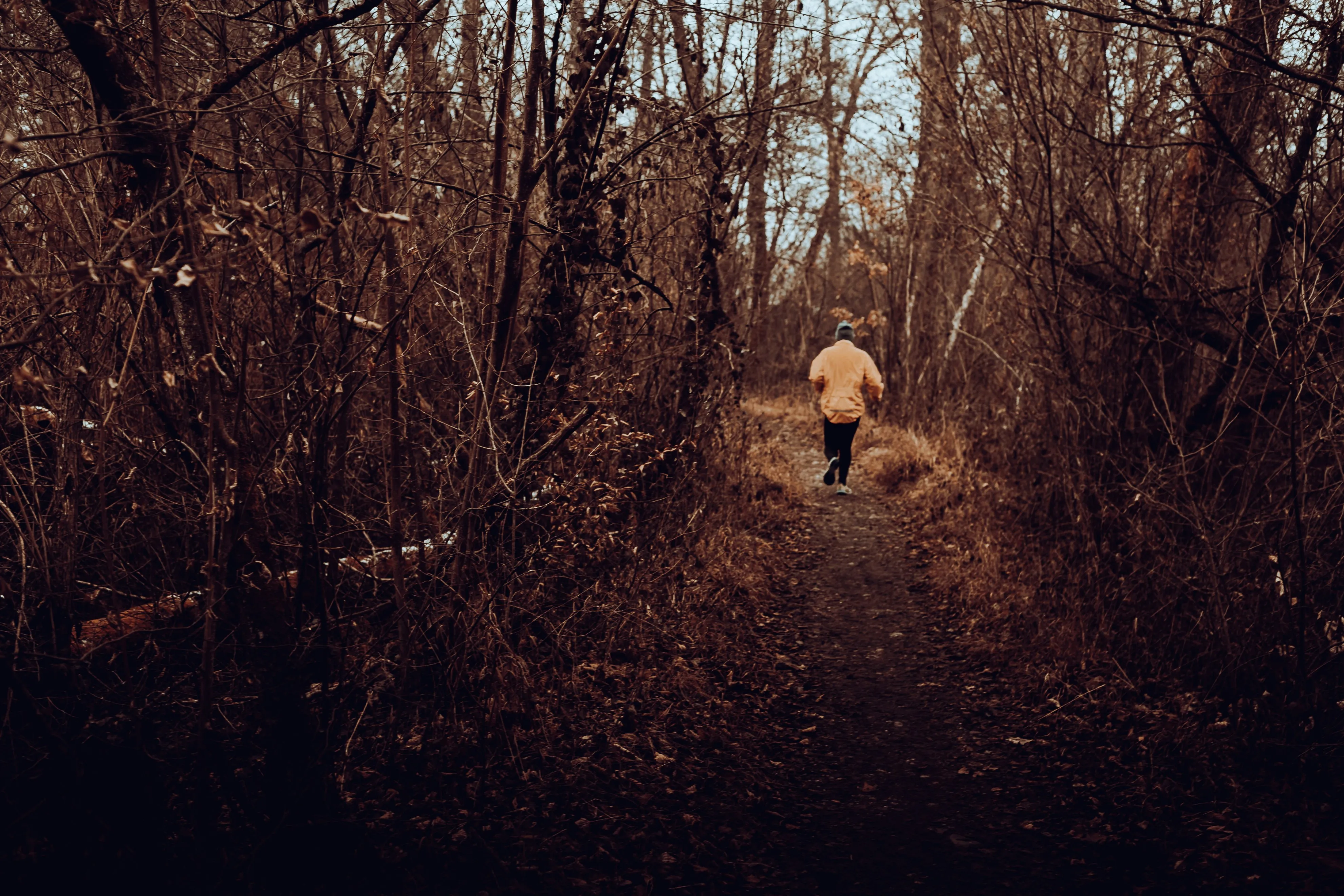 A trail runner navigates a tree-lined path in the Ottawa-Gatineau region — Gatineau Park’s trails offer a complete escape from the city in under 30 minutes
Rideau Canal Loop — 12.1 km, Intermediate
The Rideau Canal is Ottawa’s most iconic running corridor, and for good reason. Starting near Parliament Hill in the heart of downtown, the pathway traces the historic waterway through the city’s most dramatic scenery — stone locks, Victorian architecture, and the shimmering open water that becomes the world’s longest skating rink every winter. In spring, summer, and fall, it transforms into a runner’s highway with enough variety to keep you coming back.
The full Rideau Canal Loop spans approximately 12.1 kilometres, combining paved surfaces with stretches of packed dirt along quieter sections north of the core. With only about 50 metres of elevation gain across the entire route, it’s not a hill workout — it’s a speed and endurance playground. The flat, consistent terrain makes it ideal for tempo runs, easy recovery jogs, and everything in between.
Parking is available at multiple lots along the route, though spaces fill up quickly on weekends. The most convenient option for downtown runners is the parking near the Parliament Buildings at Elgin Street, or the lot at Daly Avenue. If you’re relying on transit, OC Transpo Lines 1, 2, and 7 all service stops along the canal corridor, making car-free access genuinely practical.
One crucial tip from locals: the canal is wildly popular with tourists, cyclists, and inline skaters, especially between June and September. Veteran Ottawa runners almost universally recommend setting your alarm for an early morning start. As one runner on Reddit’s r/ottawa community put it: “Rideau Canal at sunrise is magic — zero people, mist rising off the water, the whole canal to yourself.” That’s a very different experience than running the same path at noon on a July Saturday.
The Rideau Canal pathway rewards runners who pay attention to its changing character. South of Laurier Avenue, the path is wide and busy, flanked by government buildings and the Château Laurier. North of the Dows Lake section, it narrows and calms considerably, threading through tree-lined corridors that feel genuinely wild for a city centre.
Early morning on the Rideau Canal — the best time to experience this iconic Ottawa running route.
Experimental Farm Pathway — 7.2 km, Beginner-Friendly
If the Rideau Canal feels like too much commitment on a given day, or if you’re brand new to trail running and want a gentler introduction, the Experimental Farm Pathway near Carleton University is your best starting point. At just 7.2 kilometres, it’s roughly half the distance of the canal loop, yet it offers something the canal doesn’t: genuine open space and a sense of being outdoors rather than in the city.
The surface is a mix of paved pathway and grass, with about 149 metres of elevation gain — modest, but enough to give your calves a gentle workout and build the small stabilising muscles that trail running demands. The farmland setting means you’ll pass through open fields, past historic barns, and along tree buffers that block out the surrounding city noise.
The Experimental Farm is accessible year-round, making it a reliable option even in the shoulder seasons when some of the more remote trails are still waterlogged. Parking is free, and the route is forgiving enough that you can easily adjust your distance mid-run — turn around at any point and you have a simple out-and-back. A local Google Reviews comment captures its appeal perfectly: “Perfect first trails, no intimidation.”
For runners transitioning from road running to trails, this is the ideal bridge. The terrain won’t challenge your balance or technical skills aggressively, but you will get used to the uneven surfaces, small roots, and variable footing that define real trail running. Once the Experimental Farm feels comfortable, you’re ready for anything on this list.
Gatineau Park: Ottawa’s Best-Kept Trail Secret
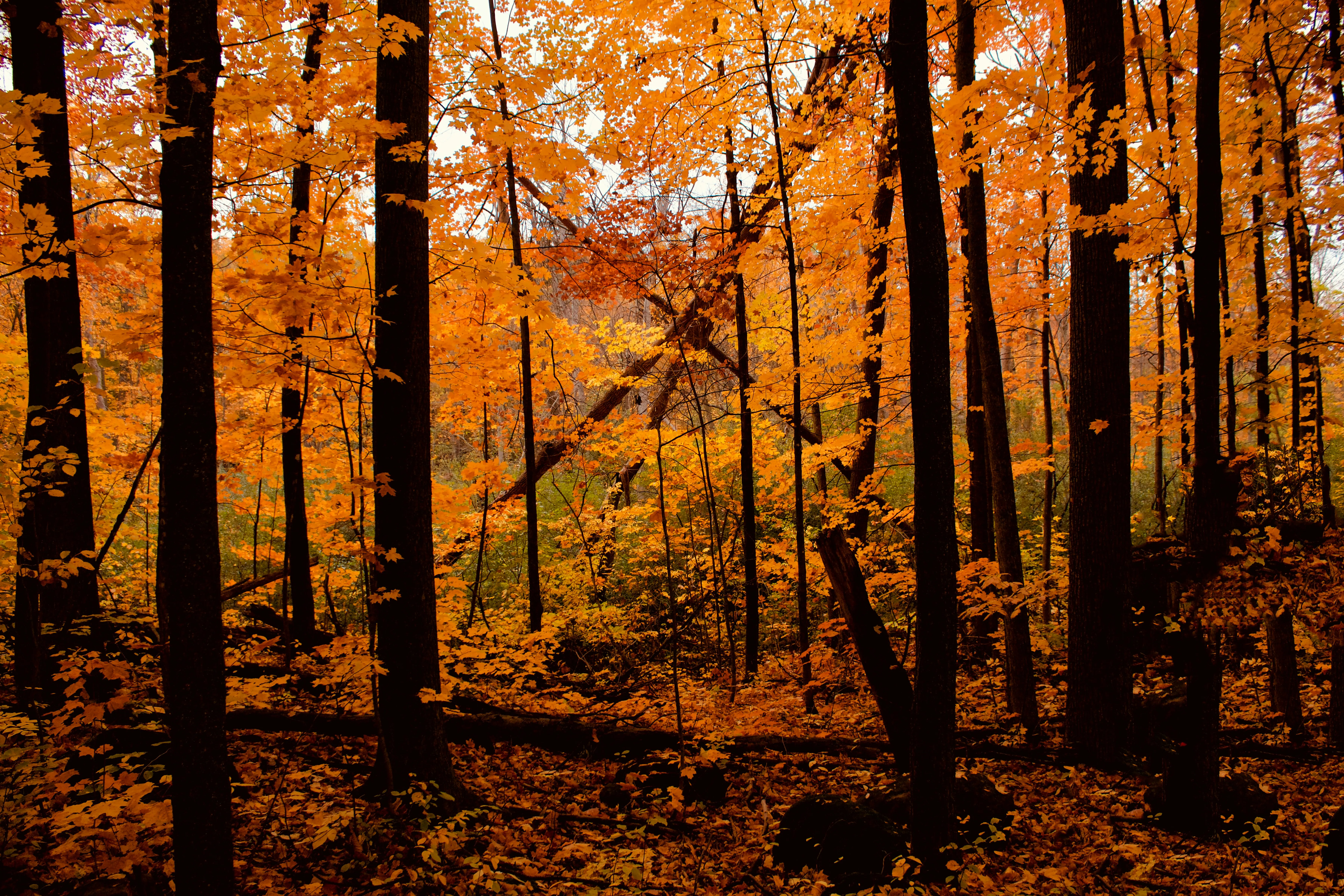 Gatineau Park’s trail network transforms with every season — autumn brings spectacular colours, while summer offers lush forest canopy cover throughout the park
Crossing the Ottawa River into Quebec takes you to an entirely different world of trail running. Gatineau Park, located at 33 Scott Road in Chelsea, Quebec, is a 361-square-kilometre protected area that feels absolutely wilderness-grade despite being less than a 30-minute drive from downtown Ottawa. Dense forests of pine and maple envelope you the moment you leave the parking lots behind, and sudden hill climbs test your cardiovascular system in ways that the flat canal pathway simply can’t match.
Gatineau Park Pathway — 8.9 km Loop, Easy to Intermediate
The Gatineau Park Pathway is the park’s flagship running loop, and for most trail runners it represents the ideal balance of challenge and accessibility. At 8.9 kilometres with approximately 216 metres of elevation gain, it demands more than Ottawa’s urban trails without venturing into technical mountaineering territory. The surface is packed dirt with exposed tree roots — nothing that requires technical footwork, but enough to keep you engaged and present on the trail.
The park charges a $10 daily vehicle access fee, which you can purchase at the gatehouse on Scott Road before heading into the park. This is one of the very few trail running costs in the Ottawa area — everything else on this list is free. That said, the fee is well worth it for what you get: well-maintained pathways that wind through bogs, open meadows, and dense forest sections that constantly shift in character and scenery.
The best months to run the Gatineau Park Pathway are May through October. Late September and early October deliver extraordinary fall colour, with the maple canopy turning shades of orange, red, and gold that make every kilometre worth the crossing. Summer runs are stunning but come with a caveat — the park’s forested sections can be buggy in July and August, so bring insect repellent and consider an early morning start.
Wildlife sightings are genuinely possible here. Runners regularly spot white-tailed deer, and the park’s ecological diversity means you’re more likely to encounter birds and smaller animals than on any city trail. Keep your headphones at a reasonable volume — or leave one earbud out — so you stay aware of your surroundings.
Gatineau Park in fall — one of the most scenic trail running destinations within 30 minutes of downtown Ottawa.
Pink Lake Trail — 5.1 km, Advanced / Technical
For runners ready to graduate from cardio to a genuine technical challenge, Pink Lake Trail is the benchmark in the Ottawa area. Despite its modest distance of 5.1 kilometres, this trail packs serious punch: approximately 200 metres of elevation gain concentrated into short, steep pitches, a surface covered in exposed rocks and tree roots, and sections that become genuinely slippery when wet.
The trailhead is accessible from the main Gatineau Park road network, with parking available at the Pink Lake parking area off Highway 5. OC Transpo does not directly service this trailhead — you’ll need a car or to arrange a ride-sharing drop-off.
 Gatineau Park’s Pink Lake is one of the National Capital Region’s most dramatic natural landmarks — the turquoise basin is surrounded by steep forested slopes accessible via the park’s 90 km of maintained trails
The reward for your effort is a striking view of Pink Lake, whose turquoise-to-emerald waters sit in a granite basin surrounded by steep forested slopes. The lake gets its name from a microscopic organism rather than its colour, but the visual result is nonetheless striking, especially from the viewpoint near the trail’s midpoint. Strava reviews from local runners consistently warn: “wear grippy shoes or regret it” — a fair caution given how unforgiving the rocky sections are after rain.
Pink Lake is best attempted from late spring through early fall. The technical terrain makes it dangerous in icy or wet conditions, and the steep sections become genuinely hazardous when slick. Experienced trail runners use this trail for hill repeats and technical leg work that simply can’t be replicated anywhere else in the region. Locals say it “builds quads fast” — and they’re not exaggerating.
For a shorter but equally memorable run, you can combine the Pink Lake trailhead with adjacent Gatineau Park loops, effectively creating a longer route with the same dramatic scenery and varied terrain.
Ottawa Greenbelt: Solitude and Year-Round Running
The Ottawa Greenbelt is a vast green space stretching across the city’s north and east edges, encompassing parks, conservation areas, forests, and agricultural land. While it lacks the dramatic elevation of Gatineau Park, it more than compensates with hidden-gem solitude, unique ecosystems, and exceptional accessibility for runners who don’t want to cross into Quebec. Multiple entry points are scattered across Orleans, Nepean, and Kanata — the Greenbelt truly rewards exploration.
Mer Bleue Bog Trail — 5 km, Easy, Year-Round
The Mer Bleue Bog Trail is the Greenbelt’s standout running destination and one of Ottawa’s most distinctive natural experiences. Located off Bearbrook Road in Orleans, the trail features a boardwalk spanning the northernmost reaches of the Ottawa River valley, giving runners access to a rare boreal bog ecosystem that would otherwise take a trip to northern Ontario or Quebec to encounter.
At 5 kilometres with minimal elevation gain, Mer Bleue Bog is technically easy. The boardwalk surface is flat and predictable, making it an excellent option for beginners, recovery runs, or anyone who wants a low-impact trail experience. The trail is open year-round with free parking, which makes it one of the most accessible natural runs in the region.
Where Mer Bleue truly shines is in autumn. The bog’s tundra-like vegetation turns in a spectacular range of colours in September and October — muted reds, tawny yellows, and deep browns — that make the boardwalk feel like a walk through a wilderness painting. One Ottawa runner’s review from a local forum captures it well: “Mer Bleue in autumn is ethereal — the light on the bog at golden hour is unlike anything else near the city.”
The main caveat is summer bugs. The bog’s wetland environment makes it a mosquito and black fly paradise from mid-June through mid-August. Locals strongly recommend wearing long sleeves and applying insect repellent liberally if you’re running Mer Bleue in summer. In spring, the boardwalk can be muddy in places after snowmelt and rain.
OC Transpo Routes 24 and 97 service the Orleans area near Mer Bleue, though you may still need a short walk from the nearest stop. Free parking makes it an easy drive-and-run option.
The boardwalk at Mer Bleue Bog in fall — a serene escape into a rare boreal ecosystem within city limits.
Linking Greenbelt Trails — 15+ km Possible, Intermediate
One of the Greenbelt’s underappreciated strengths is its ability to be linked into longer routes. Ambitious runners can connect Mer Bleue Bog with other Greenbelt trail sections — including parts of the Ottawa River pathway system and inner-greenbelt loops — to build routes of 15 kilometres or more without leaving the city’s boundaries. These linked routes lack the dramatic scenery of Gatineau Park, but they offer exceptional variety and the advantage of zero border crossing to deal with.
Urban Neighbourhood Routes: Where Coffee Meets Trail
Westboro–Ottawa River Route — 8.5 km, Easy to Intermediate
For runners who want the trail experience without fully committing to wilderness, the Westboro–Ottawa River route threads the perfect line between urban convenience and riverside freshness. Starting in the trendy Westboro neighbourhood — home to some of Ottawa’s best coffee shops and brunch spots — the route follows the Ottawa River shoreline south through the Bayswater area, mixing paved and dirt surfaces with wide views across the river to the Quebec hills.
At 8.5 kilometres with minimal elevation change, it’s a comfortable intermediate route that works equally well as a long easy run or a social weekend shuffle. Parking in Westboro is limited and street spots fill quickly on weekends — your best bet is to use OC Transpo Route 11 or 62, which both service the Westboro corridor. Alternatively, build a coffee stop into your run: park at one end, run to your favourite café in Westboro, and run back.
The route is at its best on summer evenings, when the river breeze keeps temperatures comfortable and the riverside parks fill with other active locals. The path is wide enough to share with cyclists without constant tension, though you should still stay alert on busier sections.
The Ottawa River pathway near Westboro — ideal for social runs with coffee stop built in.
Rideau River Path — 10 km, Intermediate
The Rideau River path in Old Ottawa East is one of the city’s most peaceful running corridors, and one of its most underrated. Starting near the Strathcona Park area and following the river southward through the residential neighbourhood of Old Ottawa East, the packed dirt path is wide, well-maintained, and — crucially — consistently quiet, even on pleasant weekend mornings.
At 10 kilometres, the Rideau River route is a substantial run that rewards consistent pacing. There is approximately 100 metres of elevation gain across the route, which is more than the canal but less than Gatineau Park. The river scenery is consistently pleasant, with willows trailing in the water and herons occasionally spotted on the gravel banks.
Local forum discussions consistently single out this route for its meditative quality. One runner summarised it simply: “River paths beat roads any day — pure zen.” The main practical consideration is timing: avoid peak morning commute hours on weekdays, as the path shares some sections with pedestrians and cyclists navigating to local schools and university campuses.
Trail Comparison Table
| Trail | Distance | Difficulty | Elevation Gain | Surface | Cost | Best For |
|---|---|---|---|---|---|---|
| Rideau Canal Loop | 12.1 km | Intermediate | 50 m | Paved/packed dirt | Free | City landmarks, speed work |
| Experimental Farm | 7.2 km | Beginner | 149 m | Paved/grass | Free | Beginners, year-round running |
| Gatineau Park Pathway | 8.9 km | Easy–Intermediate | 216 m | Packed dirt/roots | $10/day | Scenic forested runs |
| Pink Lake Trail | 5.1 km | Advanced | 200 m | Rocky/rooty | $10/day | Technical challenge |
| Mer Bleue Bog | 5 km | Easy | Minimal | Boardwalk/dirt | Free | Solitude, unique ecosystem |
| Westboro–Ottawa River | 8.5 km | Easy–Intermediate | Minimal | Paved/dirt | Free | Urban-trail hybrid |
| Rideau River Path | 10 km | Intermediate | 100 m | Dirt | Free | Quiet riverside running |
Trail Running Groups and Communities in Ottawa
One of the best-kept secrets of Ottawa’s trail running scene is its community. Running with others dramatically improves consistency, safety (especially in winter and bear country), and plain old enjoyment — and the city has active groups for every pace and ability level.
The Ottawa Trail Runners community operates primarily through Facebook and Strava, organising regular group runs across all the trails covered in this guide. These runs are free to join and welcome runners of all levels, though the group typically caters to those with at least some trail experience. According to r/ottawa recommendations: “Trail groups keep you motivated, especially winter” — and Ottawa winters require serious commitment to maintain a running routine.
Run Ottawa clubs host free running sessions throughout the city, with some groups specifically focused on trail and path running. The organisation also coordinates the city’s major running events, including the Run Ottawa 6 routes ranging from 6K to 15K that incorporate both road and trail sections. Check their website and social media for current schedules and meetup locations.
For those looking to dip their toes in without committing to a group, Reddit’s r/ottawa and r/running communities are active and welcoming sources of route advice, group announcements, and honest reviews of Ottawa’s running conditions.
Events and Trail Races Near Ottawa
Ottawa’s trail running calendar has something for road runners looking to transition to dirt and for experienced trail runners chasing personal records.
Gatineau Park Trail Races are held in spring and fall, with distances ranging from 10 kilometres to 50 kilometres. These events draw serious trail runners from across Ontario and Quebec and sell out quickly — register early if you’re planning to participate. The spring edition typically takes place in May, when the trails are fresh and the forest is in bloom. The fall edition in September or October coincides with peak colour season, making the scenery unforgettable even when your legs are screaming.
The Ottawa Fall Classic, held in the Greenbelt each October, is a favourite among local runners for its relaxed vibe and accessible distance options. The October timing also means you’re running through some of the most spectacular fall colour the Ottawa area has to offer.
Locals consistently describe the social atmosphere at these events as a highlight: “Events turn solo runs social” is a sentiment echoed across local running communities. If you’ve been doing solo trail runs, a local race is an excellent way to meet like-minded runners and discover routes you might not find on your own.
Gear and Running Shops in Ottawa
Getting the right gear matters more on trails than on pavement. The terrain that makes trail running so engaging — roots, rocks, mud, variable surfaces — punishes inadequate footwear and inadequate preparation in ways that road running doesn’t.
Atmosphere, located at 343 Somerset Street West in Hintonburg, is Ottawa’s go-to specialty running store for trail footwear. The staff are knowledgeable about the specific demands of local trails and can help you select shoes with appropriate tread depth, drop height, and stability for Ottawa’s terrain profile. Hintonburg is a convenient neighbourhood to visit as part of a pre-run or post-run errand — it’s walkable from several trail access points and surrounded by good coffee shops.
MEC Ottawa (Mountain Equipment Company), located near the ByWard Market, stocks a broader range of outdoor gear including trail-specific shoes, hydration packs, and Yaktrax — the traction devices that clip onto your shoes and make a genuine difference on icy or snow-covered trails in winter. MEC’s staff can advise on seasonal gear appropriate for Ottawa’s climate, where temperatures can drop well below -20°C in January and February.
For winter trail running specifically, Ottawa locals consistently recommend a merino wool base layer combined with a Gore-Tex shell. This combination manages moisture effectively during hard efforts while providing adequate wind and precipitation protection — essential when you’re running slowly through cold, wet trails in January.
Essential Apps and Trail Maps
Navigation apps have transformed trail running by making route discovery, tracking, and sharing genuinely collaborative. Three apps dominate the Ottawa trail running community.
AllTrails is the most popular route discovery platform for Ottawa and Gatineau Park runners. Search for any trail covered in this guide and you’ll find user-submitted maps, elevation profiles, photos, and real-time conditions from recent runners. The offline map download feature is genuinely useful in Gatineau Park, where cell service can be unreliable in the backcountry.
Strava goes beyond simple tracking by enabling segment competition and — critically — heatmaps that reveal which trails are most popular and which hidden sections are worth exploring. Ottawa runners frequently share that “Strava heatmaps reveal hidden gems” — the data shows where other runners have been, often surfacing trail variations and shortcuts that don’t appear on official maps.
Komoot excels for custom route planning. You can plan a specific loop, save it to your phone, and follow it turn-by-turn without needing cell service. For runners tackling the Greenbelt’s more fragmented trail network for the first time, pre-planned routes on Komoot remove a lot of the uncertainty.
All three apps work best with offline maps downloaded over WiFi before your run. Gatineau Park’s interior has significant dead zones, and even the Greenbelt’s more remote sections can lose cell signal. Downloading maps in advance is not optional for a safe run in the backcountry — it’s essential.
Seasonal Guide: When to Run Each Trail
Ottawa’s climate swings dramatically across the year, and smart trail runners adjust their routes accordingly.
Spring (April–May) is arguably the most challenging season for Ottawa trail runners. As the snow melts, lower-elevation trails — particularly the canal paths, Rideau River routes, and Greenbelt lowlands — become muddy and saturated. Runners widely recommend skipping lowland trails in April and focusing on the Experimental Farm’s better-drained sections or the elevated Gatineau Park trails. May is when the Ottawa trail running season genuinely opens up, with fresh forest growth and warming temperatures.
Summer (June–August) delivers the longest days and warmest conditions, making early morning or evening runs most comfortable. June brings black flies in forested areas — insect repellent is non-negotiable on Gatineau Park and Mer Bleue runs. July and August are hot; carry water on any run over 60 minutes and consider routes with river access for mid-run cooling.
Fall (September–October) is widely considered the finest season for trail running in Ottawa. Mosquitoes die off, temperatures are ideal for hard efforts, and the fall colour in Gatineau Park and Mer Bleue Bog is genuinely world-class. This is peak season for trail running events and group runs — the community is most active, and the scenery makes every kilometre feel worth the effort.
Winter (November–March) requires the most significant gear adjustment. Gatineau Park maintains ** snowshoe trails** in winter — the same paths used for running in warmer months are groomed for snowshoe use, but many experienced trail runners continue running them in appropriate footwear. Yaktrax or similar traction devices are essential for any icy or snow-packed surface. Temperatures can plummet to -25°C or colder; layered merino and Gore-Tex becomes non-negotiable. Running in darkness requires a headlamp — this is not optional on Ottawa’s winter trails.
Safety Considerations for Ottawa Trail Runners
Ticks and Lyme Disease
Ottawa has a documented tick population, and the risk of Lyme disease is real and growing. Ticks are most active from April through October and are found throughout the Greenbelt, Gatineau Park, and even in urban parks with sufficient vegetation. Always check your body thoroughly after every trail run — ticks favour warm, hidden spots: behind the knees, in the groin, under the arms, and along the hairline. If you find a tick, remove it promptly with fine tweezers and monitor for symptoms. The City of Ottawa operates a tick surveillance program, and local public health units can test removed ticks for Lyme disease.
Black Bears in Gatineau Park
Gatineau Park is black bear country. Encounters are uncommon on busy trails but not unheard of, particularly in early morning and evening hours. Recommended precautions include running with a partner or group, making noise on blind corners and in dense sections (some runners use small bear bells attached to their shoes), and carrying bear spray in very remote sections. Never run with headphones loud enough to block environmental sounds in bear habitat.
Trail Conditions and Weather
Pink Lake Trail becomes genuinely hazardous when wet — the steep, rocky sections that are manageable in dry conditions become slippery and dangerous after rain. Check conditions before heading out, and if the trail is wet, consider an alternative. The same caution applies to Gatineau Park’s root-covered sections after heavy rain.
Ottawa’s weather can change rapidly, especially in spring and fall. Carrying a lightweight rain shell is standard practice for experienced Ottawa trail runners, even when the morning forecast looks clear. Mountain weather systems rolling in from the west can transform a pleasant run into a cold, wet ordeal within an hour.
Winter Running Hazards
Winter trail running in Ottawa requires specific preparation. Snow-packed and icy trails demand proper traction devices — running on untreated trails in dress shoes or road running shoes is genuinely dangerous. Navigation becomes harder in winter when snow obscures trail markers. Carry a phone (keep it warm against your body to preserve battery), tell someone your route and expected return time, and don’t push solo runs too far into remote sections during extreme cold.
FAQ
Q: What is the best trail running route for beginners in Ottawa?
The Experimental Farm Pathway near Carleton University is the best entry point for beginners. At 7.2 kilometres with only 149 metres of elevation gain, the flat, forgiving terrain lets new trail runners build confidence without technical challenges. The trail is accessible year-round with free parking, and you can easily shorten the route by turning around whenever you want.
Q: Do I need to pay to run in Gatineau Park?
Yes. Gatineau Park charges a $10 daily vehicle access fee for all visitors, including runners who drive into the park. This fee is collected at the gatehouse on Scott Road in Chelsea, Quebec. All Ottawa city trails, including the Rideau Canal, Experimental Farm, Greenbelt trails, and Mer Bleue Bog, are free to access.
Q: How do I get to Ottawa’s trail running routes without a car?
OC Transpo services several trail access points. Lines 1, 2, and 7 stop near the Rideau Canal corridor; Lines 11 and 62 service Westboro; and Lines 24 and 97 reach the Orleans area near Mer Bleue Bog. Gatineau Park and Pink Lake Trail require a car, ride-share, or cycling. Biking to trailheads is a popular option among Ottawa runners who prefer to go car-free.
Q: Are there trail running groups in Ottawa?
Yes. Ottawa Trail Runners organise free group runs through Facebook and Strava, welcoming runners of all levels. Run Ottawa clubs also host free sessions around the city. Trail groups are especially valuable for motivation during Ottawa’s challenging winters, and for safety in Gatineau Park’s bear country.
Q: When is the best time of year for trail running in Ottawa?
Fall (September–October) is widely considered the best season for trail running in Ottawa. Temperatures are ideal, mosquitoes have died off, fall colours in Gatineau Park and Mer Bleue Bog are spectacular, and trail conditions are generally excellent. Summer (June–August) is also excellent if you can manage the heat and bugs, while winter (November–March) rewards dedicated runners with uncrowded trails and a unique atmosphere.
Q: What should I wear for trail running in Ottawa’s winter?
Layering with a merino wool base and a Gore-Tex shell is the foundation of a functional Ottawa winter running wardrobe. Traction devices (Yaktrax or similar) are essential for icy trails. Temperatures can reach -25°C or colder, so cover exposed skin, carry your phone warm against your body, and tell someone your route before heading out.
Q: Is trail running in Ottawa safe?
Trail running in Ottawa is generally safe when you take basic precautions. The main risks are ticks (carry repellent and check yourself after every run), black bears in Gatineau Park (run in groups, make noise), icy trail conditions in shoulder seasons, and standard outdoor hazards like twisted ankles on roots and rocks. None of these risks should discourage you from running Ottawa’s trails — they’re manageable with preparation.
Q: Can I do trail running races in Ottawa?
Yes. Key annual events include the Gatineau Park Trail Races in spring and fall (distances from 10K to 50K), and the Ottawa Fall Classic in the Greenbelt each October. The Run Ottawa 6 event series offers distances from 6K to 15K with both road and trail sections. These events typically sell out quickly, so plan ahead.
Q: What apps are best for trail running in Ottawa?
AllTrails is excellent for route discovery and conditions; Strava provides segment tracking and heatmaps that reveal popular routes and hidden gems; Komoot excels for planning custom routes with turn-by-turn navigation. All three work best with offline maps downloaded over WiFi before your run.
Q: How long does it take to run the Pink Lake Trail?
Pink Lake Trail is 5.1 kilometres with 200 metres of elevation gain and technical rocky terrain. Most intermediate trail runners complete it in 35–55 minutes. Beginners on technical terrain should allow up to 70 minutes. Because of the steep, uneven footing, it’s worth slowing down and savouring the view of Pink Lake rather than rushing.
Q: Are dogs allowed on Ottawa’s trail running routes?
Rules vary by trail. Dogs are generally welcome on Ottawa city trails including the Rideau Canal pathway, Experimental Farm, and Greenbelt trails, provided they are leashed and you clean up after them. Some Gatineau Park trails have specific dog restrictions — check the NCC’s regulations before bringing your dog. If you’re looking for dog-friendly running routes, our guide to dog-friendly Ottawa parks and trails covers off-leash areas and dog-friendly trail networks.
Q: How does Ottawa’s trail running compare to other Canadian cities?
Ottawa punches above its weight for a city of roughly one million people. Gatineau Park alone — with its dense forests, significant elevation, and proximity to downtown — rivals trail running offerings in cities twice Ottawa’s size. The Greenbelt and canal network give Ottawa exceptional trail density within city limits. Compared to Montreal (more urban trail options, less wilderness access), Vancouver (superior mountain trails but far more crowded), or Toronto (larger running community but fewer true trails within the city), Ottawa offers an unusual combination of wilderness access and urban convenience.
Q: What is the longest continuous trail running route in Ottawa?
The Rideau Canal Loop at 12.1 kilometres is the longest single signed route in central Ottawa. However, ambitious runners can link the Westboro–Ottawa River path, canal sections, and Greenbelt connector trails into routes of 20+ kilometres without significant road crossings. Gatineau Park’s network of trails can be combined into significantly longer loops for those with the time and fitness.
Final Thoughts
Ottawa doesn’t always come to mind when Canadians think of trail running destinations — cities like Vancouver, Calgary, and even Montreal tend to dominate those conversations. But spend a season exploring Ottawa’s trail network and you’ll quickly understand why local runners are so fiercely loyal to their city’s paths. Gatineau Park’s 8.9-kilometre Pathway through bog and forest, Pink Lake’s punishing 5.1-kilometre technical challenge, Mer Bleue Bog’s ethereal boardwalk solitude — these aren’t consolation trails for a capital that lacks better options. They’re genuinely excellent trails that happen to be a 30-minute drive from Parliament Hill.
The key to enjoying Ottawa’s trail running scene is seasonal awareness and route selection. Match your fitness and experience level to the right trail: start with the Experimental Farm’s forgiving terrain, build to the Rideau Canal’s 12-kilometre variety, graduate to the Greenbelt’s linked routes, and finally tackle Gatineau’s hills and Pink Lake’s technical challenge. Join a group for winter motivation, download your maps before heading out, carry insect repellent in summer, and check yourself for ticks in every season.
Once you know where to go and when to go there, Ottawa’s trail running network reveals itself as one of the most complete and rewarding in eastern Canada.
Sources: Run Ottawa (runottawa.ca); Best in Ottawa trail running guide (bestinottawa.com); Komoot Ottawa running trails (komoot.com); Ottawa Tourism outdoor running guide (ottawatourism.ca); Reddit r/ottawa community recommendations; Strava Ottawa trail reviews.
For more ways to enjoy Ottawa’s outdoors, explore our guides to hiking trails near Ottawa, cycling trails in Ottawa, and Gatineau Park in every season.